
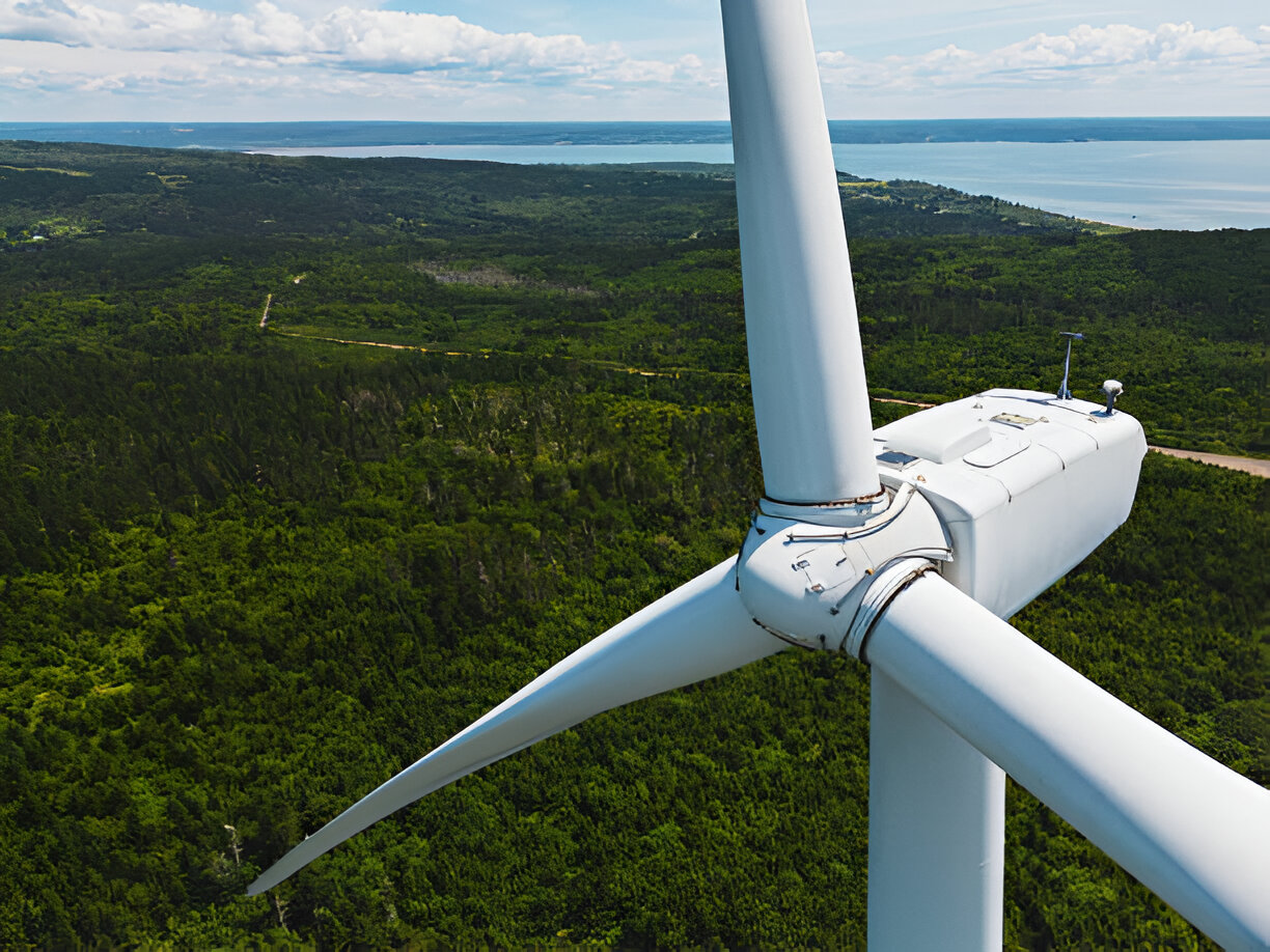
Turbine Inspection
Key Applications:
High-Resolution Imaging: Drones equipped with 4K cameras capture microscopic cracks, erosion, and delamination.
Thermal Inspection: Advanced thermal sensors identify overheating components and electrical anomalies.
360° Blade Coverage: Inspect hard-to-reach blade tips and leading edges with precise maneuverability.
Thermal Inspection: Advanced thermal sensors identify overheating components and electrical anomalies.
360° Blade Coverage: Inspect hard-to-reach blade tips and leading edges with precise maneuverability.
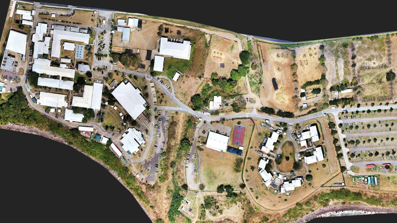
Construction Site Mapping & Monitoring
Key Applications:
Topographic Surveys: Generate accurate digital terrain models (DTMs) and digital surface models (DSMs) for pre-construction planning.
Progress Monitoring: Time-lapse aerial imagery to document construction phases and compare against project schedules.
3D Modeling & BIM Integration: Integrate 3D maps with Building Information Modeling (BIM) software for enhanced project visualization.
Progress Monitoring: Time-lapse aerial imagery to document construction phases and compare against project schedules.
3D Modeling & BIM Integration: Integrate 3D maps with Building Information Modeling (BIM) software for enhanced project visualization.
Road Planning & Infrastructure Development
Key Applications:
Corridor Mapping: High-resolution imagery for road alignment, route selection, and impact assessment.
Slope Analysis & Cut-Fill Calculations: Identify terrain challenges and optimize earthwork planning.
Pavement Condition Assessment: Detect surface defects, potholes, and cracks for maintenance planning.
Slope Analysis & Cut-Fill Calculations: Identify terrain challenges and optimize earthwork planning.
Pavement Condition Assessment: Detect surface defects, potholes, and cracks for maintenance planning.
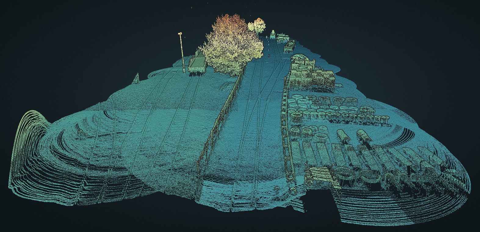
Railway Surveys & Monitoring
Key Features:
Track Alignment & Deformation Monitoring: Detect shifts, warping, and misalignments using high-resolution orthomosaic maps.
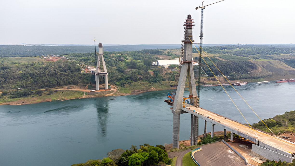
Bridge & Tunnel Inspections: Conduct detailed inspections of structural elements in hard-to-reach areas.
Vegetation Encroachment Analysis: Identify overgrowth that may interfere with rail operations.
Bridge & Tunnel Inspections: Conduct detailed inspections of structural elements in hard-to-reach areas.
Vegetation Encroachment Analysis: Identify overgrowth that may interfere with rail operations.
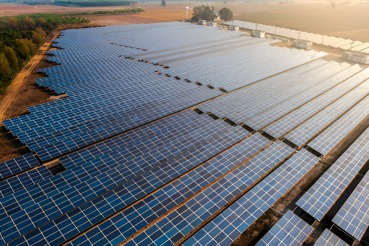
Solar Farm Inspection
Key Applications:
Thermal Imaging for Hotspot Detection: Quickly identify underperforming or faulty solar panels, hotspots, and damaged cells that can lead to energy losses.
Panel Alignment & Shading Analysis: Ensure optimal panel positioning and detect shading issues that reduce efficiency.
Electrical Fault Detection: Identify issues in junction boxes, connectors, and inverters without manual inspections.
Panel Alignment & Shading Analysis: Ensure optimal panel positioning and detect shading issues that reduce efficiency.
Electrical Fault Detection: Identify issues in junction boxes, connectors, and inverters without manual inspections.
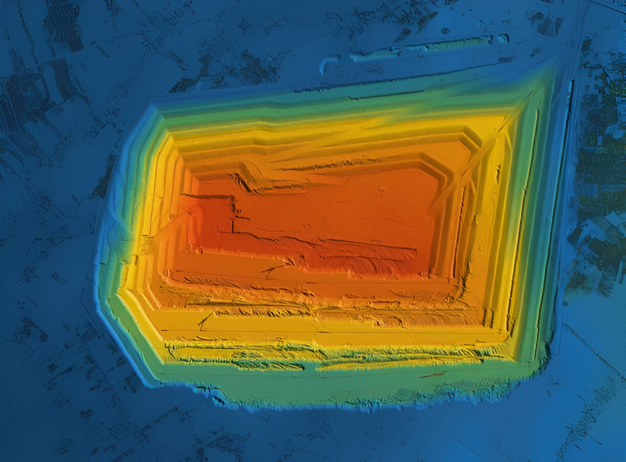
Mining & Quarry Surveying
Key Applications:
Volumetric Stockpile Measurements: Precisely calculate the volume of extracted materials, stockpiles, and waste dumps for inventory management.
Pit & Bench Mapping: Generate detailed 3D models of open-pit mines and quarry benches for better planning and slope stability analysis.
Blast Planning & Monitoring: Capture pre- and post-blast data to optimize blast efficiency and minimize environmental impact.
Pit & Bench Mapping: Generate detailed 3D models of open-pit mines and quarry benches for better planning and slope stability analysis.
Blast Planning & Monitoring: Capture pre- and post-blast data to optimize blast efficiency and minimize environmental impact.